Random Tandem
Chapter 1
You are on holiday in the state of Uttarakhand – Uttarakhand’s name is derived from the Sanskrit words Uttara (उत्तर) meaning ‘north’, and Khaṇḍa (खण्ड) meaning ‘land’, together simply meaning ‘Northern Land’. Do you know what the other Cardinal directions are called in Hindi? Uttara we know is North, Dakshin is South, Poorva is East and Paschim West! Formerly known as Uttaranchal, it is also often referred to as the Devbhumi (literally: “Land of the Gods”) due to many temples and pilgrimage centres found throughout the state. Do you know the name of another state that has a similar epithet? Here’s a hint, it lies in the ‘dakshin’ part of our country, along the ‘paschim’ coastline! You got it – Kerala it is!! It is also referred to as ‘God’s own country’ – but for very different reasons, which may be well worth your while to find out when you have some time on hand.

The state of Uttarakhand is made up of two culturally and linguistically distinct regions – Garhwal in the Northwest and Kumaon in the Southeast – a division that the ‘pahadis’ as they distinguish themselves, take very seriously. The rivalry between these two groups of mountain dwellers is legendary and goes back forever! But at the moment you happen to be in the Kumaon region, bounded on the east by Nepal, on the south by the state of Uttar Pradesh, on the west by the arch rivals, the Garhwalis and on the north by Tibet. The main rivers of this area are Gori, Dhauli, and Kali, which rise, chiefly in the southern slope of the Tibetan watershed north of the loftiest peaks. The river Ramganga, flowing through Uttarakhand, is the natural dividing line between the Kumaon and the Garhwal regions. By the way, if you are at the riverside, the name of the river flowing through and alongside the property is called Kalsa.
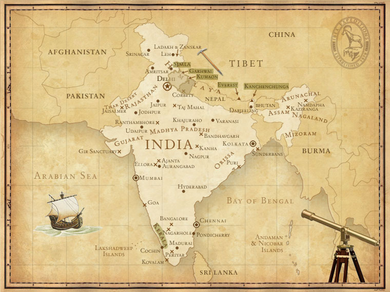
Dehradun is the state capital, while Nainital is the administrative centre of Kumaon Division. The region of Nainital was once called the ‘City of Lakes’ or ‘Chakta’ as there were 60 lakes in the area. As one drives into bustling ‘Nynee-thal’ as the British then pronounced it, it is difficult to imagine that few outsiders knew of its existence till early 19th century. George William Traill, the first British deputy commissioner of Kumaon between 1815-35 learnt of this enchanting lake ringed by mountains and meadows from locals who celebrated an annual fair here.
View of the north end of Naini Tal, with the new Assembly Rooms in the foreground
(image source: www.nainitaltourism.com)
His love for them and their simple pahadi ways made him keep its location a well-guarded secret for years, for he feared that such a beautiful spot would become an escape from the hot North Indian summer, and the influx of people would besmirch its pristine environment. Almost 2 centuries later, looking at the hordes of holidayers and tenements crowding the hills proved Traill’s worst fears have come true…
The British discovered Nainital in 1841 and subsequently used it as the capital of the United Provinces. The inability of the British to cope with the heat of the plains, necessitated the need for an alternate administrative capital during the extended periods of particularly hot summers. As a matter of historical fact, the British considered shifting India’s summer capital to Nainital but a geophysical survey ruled out the construction of a railway line due to fragile nature of the hills. Thus, Shimla, another beautiful hill station, affectionately called Chhota Vilayat or Little England because of its likeness to the weather ‘back home’ finally received that honour.
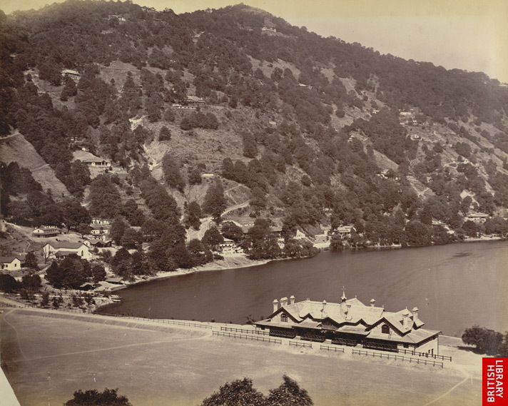
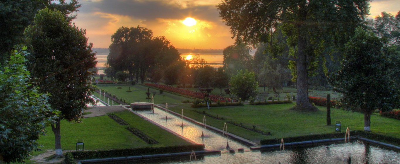
The concept of building summer retreats, however was not new, and can be traced back to the times of Akbar under whom Kashmir was annexed to the great Mughal Empire. Thereafter, it became the private gardens of the Mughal Emperors and their favourite summer retreat. The many Mughal gardens, including the Shalimar Bagh and the Nishat gardens are a living testament to their love for Kashmir, not to mention the famous words uttered by Jehangir while living in a houseboat on Dal Lake that still echo down the annals of time – as true now as it must have been then…. “Gar firdaus, ruhe zamin ast, hamin asto, hamin asto, hamin ast – meaning “that if paradise is anywhere on the earth, it’s here, it’s here, it’s here.…
Nishat Bagh
(image source: www.kashmirhills.com)
Shalimar Bagh
(image source: www.trekearth.com | www.wikimedia.org)
There aren’t any records of how high summer temperatures rose during Shahjahan’s day—either in Dilli or across the rest of the northern plains—but one can safely assume that they probably wouldn’t have been much different from today’s broiling heat. While for the Emperor, his court, and the very wealthy, the solution was to leave the plains and spend the summer in the cool green Kashmir Valley, one cannot help but wonder, how those who didn’t have the option to travel coped with the heat back then…??? Tehkhanas or basements, fragrant Khus or vetiver grass mats sprinkled with water, terrace and outdoor bedroom, cooling drinks were the order of the day….pretty much the same before the advent of the fans, coolers and air conditioners.
The British however, did not go so far north and stopped just short of Kashmir and established the first hill station in Shimla. We have but, the enduring battle with their ‘one bitter enemy’ to thank, that all their policies and intrigues failed to get the better of, for the mushrooming of hill stations across the length and breadth of India. No prizes for guessing what this one continuous challenge was, that eluded their overlordship and rather got the better of them…. The Great Indian Heat & Dust! FYI, 80 such hill stations were established across the length and breadth of our country under the British rule! Good enough to play a couple of rounds of ATLAS, wouldn’t you say?? So beginning with ‘S’ brings us back to…..Shimla.
Do you know which state Shimla is located in? Yes! Located in the state of Himachal Pradesh, Shimla is till date, like Nainital is a very popular tourist destination especially in the summers! Which state do you come from? And what the names of the neighbouring states around you? And name of your state capital is…..
There are several theories regarding the origin of the word Kumaon.
Kurma Avatar – The Churning of The Ocean of Milk – Indian Miniature Painiting
(image source: Wikimedia Commons)
One version based on our ancient mythology, is that the word Kumaon is derived from “Kurmanchal”, meaning land of the Kurmavatar – the tortoise incarnation of Lord Vishnu.
 However a more historical theory is that the word Kumaon can be traced back to the 5th century BC, when it is believed that the Kassite Assyrians left their homeland ‘Kummah’, on the banks of river Euphrates, and settled in the northern part of India. These settlers formed the Koliyan tribe and named their new settlement ‘Kumaon’. Lord Buddha’s mother, Mayavati, belonged to this clan. Do you know the name given to Lord Buddha by his parents? He was called Siddhartha – meaning ‘one who has accomplished a goal’. The name chosen by his parents is almost prophetic in nature for he not only achieved the goal of liberating himself, but also became the path for millions to follow. Buddha and his teachings have stood the test of time, and remain relevant even today, 2500 years after him.
Names given by parents, in some way reflect the dreams they see for their children, an ideal that they hope will prove to be a constant source of inspiration to their children or perhaps a blessing that they wish, their children will be fortunate enough to receive, in their lives. Or is it something deeper? Maybe some dreams and aspirations of an elder in the family, which for some reason remained unfulfilled, that they now hope will somehow be fulfilled by the newborn child.…
Have you ever wondered what your own name means? It would be interesting to know the story behind your name! And there’s just one way to find out….ask mom & dad about it! And what better timing to chit chat with them, than on a holiday like this, when everyone is far from the maddening crowd and their more maddening schedules, with the glorious mountains a quiet party to all your chatter chatter!
86% of the state of Uttarakhand is mountainous and most of the northern part of the state is covered by – you got it – the mighty Himalayas. Do you know how this youngest mountain system stretching across 6 different countries, gets its name? In Sanskrit, ‘Him’ means snow and ‘Alaya’ means abode… So these snow-capped mountains were rightly named, as Himalayas, which literally translates into ‘the abode of snow’. Very few of us know that geologists have performed tests over years to prove that The Himalayas are geologically still alive – growing approximately 20 mm every year! And the very same geologists tell us the very interesting story about the birth of these mammoth mountains….
During the Jurrasic age, when the mammoth dinosaurs roamed the freely on the land, the earth’s surface had two supercontinents – Laurasia in the Northern Hemisphere and Gondowanaland in the southern. Millions of years thereafter, at the time when the first modern mammal like rats and guinea pigs were evolving, and most of the Earth was covered in forests, the land that is now India, broke off from what is now Africa and floated slowly away until, it bumped into Asia. The force of this impact slowly pushed the land between them to fold up into big Asian mountain ranges, including the Himalayas.
This mountain chain that crowns the Indian subcontinent in the north can be sub-divided into namely the:
- Kashmir Himalayas
- Himachal Himalayas
- Uttarakhand Himalayas
- Nepal and Bhutan Himalayas
- Arunanchal Himalayas
The earliest historical references to the Uttarakhand Himalayas are found in the Vedas. Specific mention of these mountains exists in the Mahabharata, when the protagonists of the epic, the Pandavas, are said to have ended their life on earth by ascending the slopes of a peak in Western Garhwal called Swargarohini – which literally means the ‘Ascent to Heaven’.
 From the deck @ Soulitude
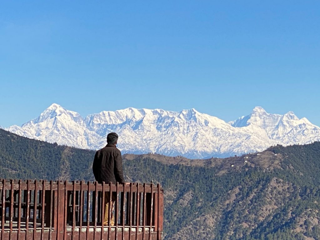
If you step out onto the deck, you will see the impressive range of snow crested Himalayan peaks that almost kiss the heavens – no wonder that the ancient Hindus assumed that the towering peaks served as a stairway to the gods! As you look straight at the 340 km panorama of the mountains, which direction do you think you are facing? North it is! So if North is bang in front of you, which directions would be to your left and right? Left would point to ‘Paschim’ and Right would be towards ‘Poorva’. You can reconfirm this by seeing the movement of the sun as well. It rises in the East, from behind the hills to your right and then by midday travels overhead, before finally setting in the West, behind the hills on your left!
The movement of the sun plays a big role in the pahadi way of life. It not only determines the location of building homes, but also the height of the construction. Since hill towns lying above 28°N latitude: i.e. all hill towns located in north India, including both our own locations, get no direct sun from north side, thus southern slopes are most preferred for building of homes. More so the homes tend to be south open, so that they are orientated to maximise the entry of the sun rays within the living quarters which is an essential component for hill living, where the cold could get to the bones….and the warmth of the sun would be necessary for thawing!
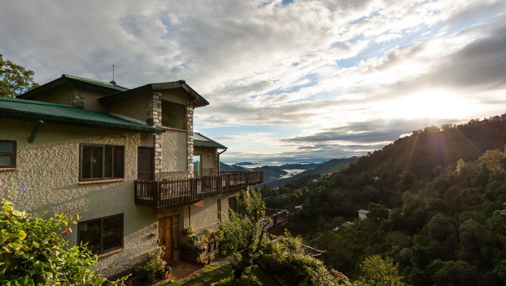
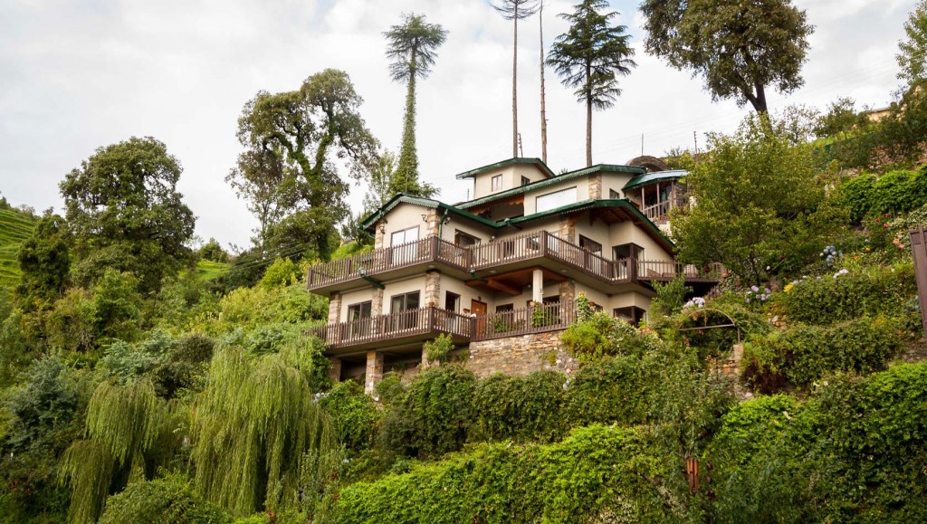
So both the homes at Gagar have been built on a southern slope, with as many opening on the southern walls to freely allow the sun in, but at the same time have been designed to face the North, so that the views are maximised too. In fact most rooms at the property are oriented towards the picture perfect view of the splendid peaks just up north.
So with your directions now sorted, as you stand face to face with this panoramic view, can you figure out which should be the Garhwal side and which should be the Nepal side of the range? Once your bearings are right, you can use the reference given below to identify the many peaks in front of you. Since we were talking about the Pandavas, let us first try and locate the Panchachuli peaks….
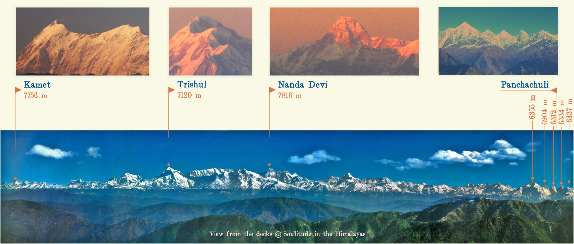
Look towards the Nepal side and use the image given below as a guide to identify this the Panchachuli Peaks. The Panchachuli Peaks (6355m, 6904m, 6312m, 6334m, and 6437m) are a group of five snow-capped Himalayan peaks near Munsiyari. The name is derived from the legendary Pandava’s “Five Chulis” (five cooking hearths), where it is believed that they cooked their last meal before proceeding towards their heavenly abode.
While you are at it, try and identify the other peaks too…
Towards the Garhwal side, using the reference image, you will see Kamet, (7756m) ‘the huge grandmother of a sacred snow chain’ resembles a giant pyramid topped by a flat summit area with two peaks. At dawn and dusk, Kamet’s copper coloured rocks reflect the sun’s rays on its glaciers and bathe them in a red burning glow. Hence the term ‘Glacier Fire’ is also used to allude to it.
Trishul (7120 m) is a group of three Himalayan peaks that resemble the trident or the ‘Trishul’ – The weapon associated with Shiva. The play of light and shadows at dusk and dawn highlight the triple peaks so well that all three of them together look very much like the trident.
Nanda Devi, (7816 m) is the second highest peak in India, Nanda Devi – meaning ‘the Bliss-giving Goddess’ another name of Goddess Parvati, is regarded as a patron goddess of the Uttarakhand Himalayas. This peak with its chain of encircling mountains i.e. the Nanda Devi Sanctuary is closed to all. The surrounding Nanda Devi Park was declared a UNESCO World Heritage Site in 1988.
Do you know the name of the highest Himalayan peak in India? The Kanchenjunga is the highest mountain peak in India and ranked 3rd highest summit in the world. It is located at the border of India and Nepal in the Great Himalayas Range in Sikkim. And which is the highest Himalayan peak in the world? The Mt Everest – which the Nepalese prefer to call “Samgarmatha” which translates into ‘Goddess of the Universe’ or ‘Forehead of the Sky’.
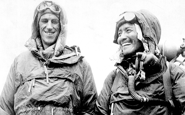
Sir Edmund Hillary (left) and Sherpa Tenzing Norgay
(image source: www.nationalgeographic.com )
Tenzing Norgay, with his partner Edmund Hilary were the very first people to ascent Mt.Everest. It is believed, that upon reaching the summit, Hillary offered a congratulatory handshake to Tenzing but that was not sufficient. Tenzing threw himself at Hillary and gave him a hearty Sherpa hug! While Hillary took some photos, Tenzing knelt down and buried a small red and blue pencil given to him by his daughter and an offering of sweets in the summit snow and then said a short prayer. By the way, he was wearing woollen socks hand knitted by his wife and his Swiss reindeer boots were on their third expedition! Also another interesting fact to know about this great mountaineer was that, as was common in those days, the exact date of his birth was unknown, although going by the weather and the crops, he knew that it was some where in late May. So after his ascent of Everest on 29 May 1953, he decided that henceforth he would celebrate his birthday on the very same day!! Great idea, wasn’t it? A kind of a two in one celebration!!
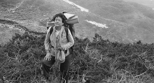
Bachendri Pal
(image source: www.kafaltree.com)
Any idea who was the first woman ever to climb the Everest? Hailing from Uttarakhand itself, she is none other than Bachendri Pal. She created history in, 1984, when she achieved this amazing feat at the age of 30! Not may know that due to an accident that occurred during the climb many members of her team were injured. However, despite a head injury Bachendri chose to continue the ascent. On 23 May 1984, Bachendri reached the summit and remained there for about 43 minutes, becoming the first Indian woman to scale the Mount Everest, and the fifth woman in the world.
Shimmering with fresh snow, the views of the Himalayas are simply spectacular during the winter months, right until March. In the summers and the monsoon months, they become a bit more elusive. As the clouds serenade the mountains, the peaks occasionally, teasingly oblige with a fleeting glimpse – which doesn’t really quench the thirst, but instead fires up the desire to see them even more! This playful hide n seek continues for a couple of months. The long wait finally comes to an end with the beginning of October as the veils of the Himalayas begin to lift once again to reveal their dazzling beauty! Nature, is literally at its peak!
Most of these peaks are best viewed early morning or late evening…so if you actually want to see them at their best, it wouldn’t be a bad idea to put an alarm and wake up a bit early on just one day… Depending on the time of the year you are here, wear a warm or a warmer jacket, and step out of your room onto ‘any of the many’ decks around and wait for the sun to peep out of the horizon. As dawn breaks, through the blanket of darkness, the early morning sky is heady mix of pinks and oranges, the burnished tones of which are reflected on the mountains, lighting them up in the most beautiful way possible. As the first rays of the sun hit the mountains, it envelopes them in a rare quality of beauty, that actually tugs at the heartstrings within. The oft heard expression ‘feel the beauty’ becomes a reality in this moment in time!
Observe and absorb! As the mountains take over and cast a spell….and time stands still…
Let the experience seep in… And don’t be in a hurry to capture the moment on a frame. Capture it within instead! Let it be a firsthand experience of standing face to face with the majestic Himalayas, for you! Not a second hand one via a gadget!
After you are filled with the Himalayas, here’s an interesting activity for you…… pick up a pencil and a piece of paper, and just doodle a mountain range…it will probably look like a zig zag….now you could probably detail in the mountain peaks with another set of irregular zig zag and make little trees to mark the valley…now observe your own little sketch, and see if you can spot a pattern…it’s very simple for all to see that each peak is followed by a valley, and each valley by a peak…one follows the other….so what do you think the peaks and valley point to? It is as if, they are trying to tell us that Life is like an adventure, much like a trek up and down the mountainside, between the two defining points – the peak and the valley. With a lot of hard work, perseverance and stamina, one goes uphill, and on reaching the top, we feel ecstatic, elated and on top of the world. But the wise snowcapped peaks, know that it is but one half of the journey, and BOO! The valley is waiting just there….round the bend. Soon a dip of emotions is a likely to happen….and there’s nothing wrong in being in the valley…it is just the starting point of the next peak….And here it is….
Look deep, and if you do
The veils will lift, just for you!
And
the revelation will..
Stun all and one!
That
The peaks and their boo
Aren’t really two
And if you look deep enough
You’ll see it through and through!
‘Tis a myth and
What’s really true
Is that they are but
Two parts of One!